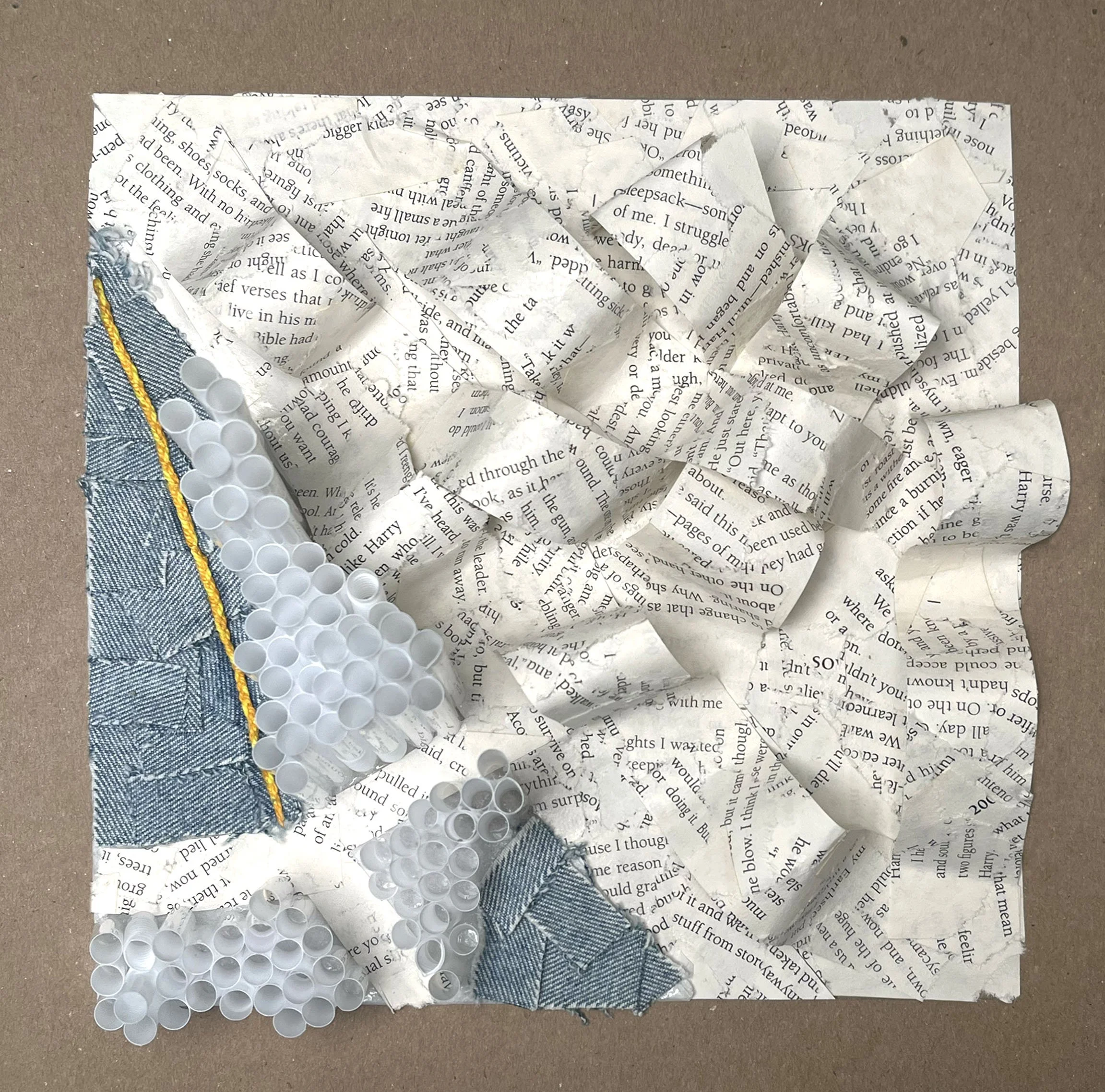
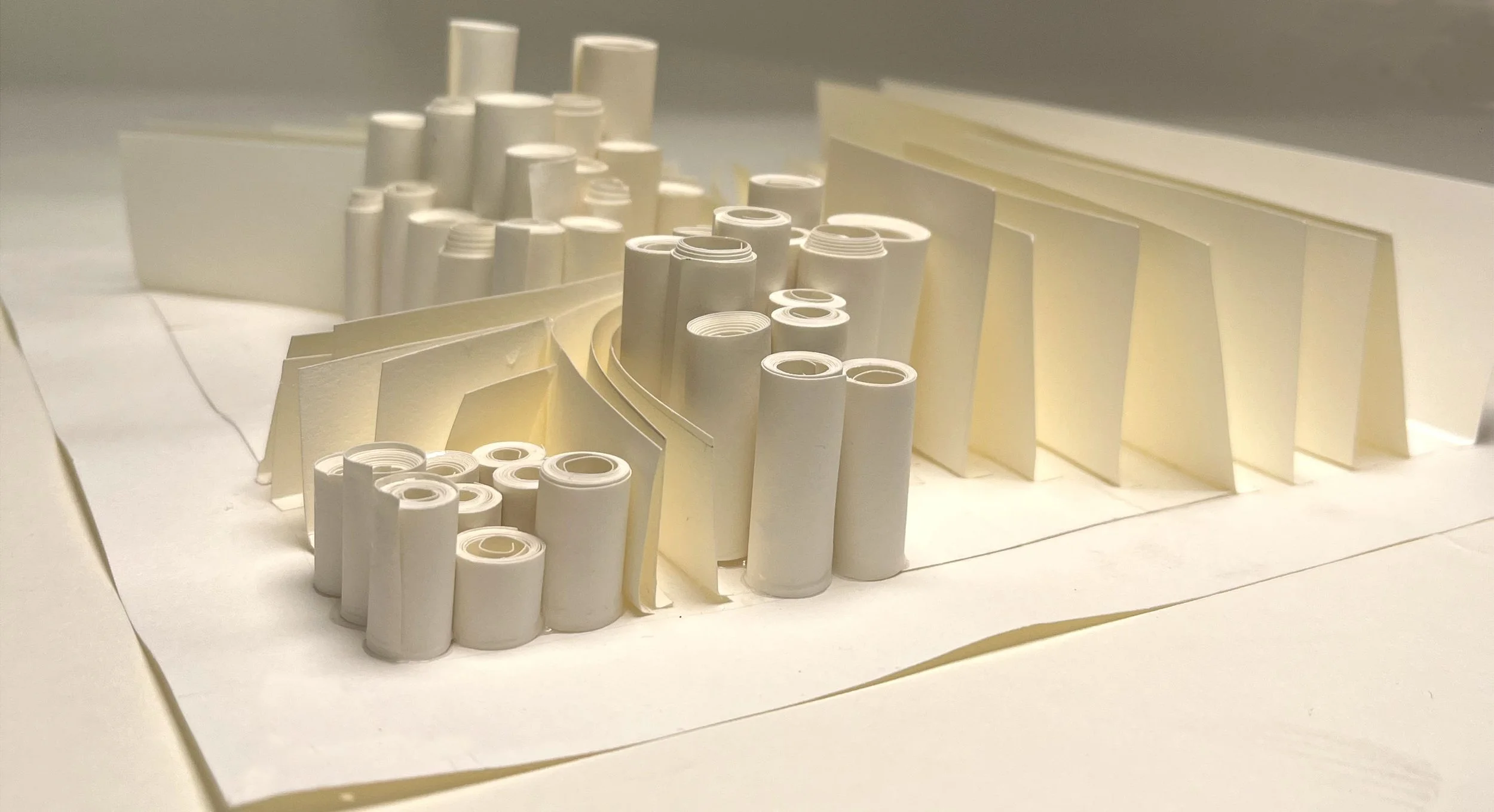
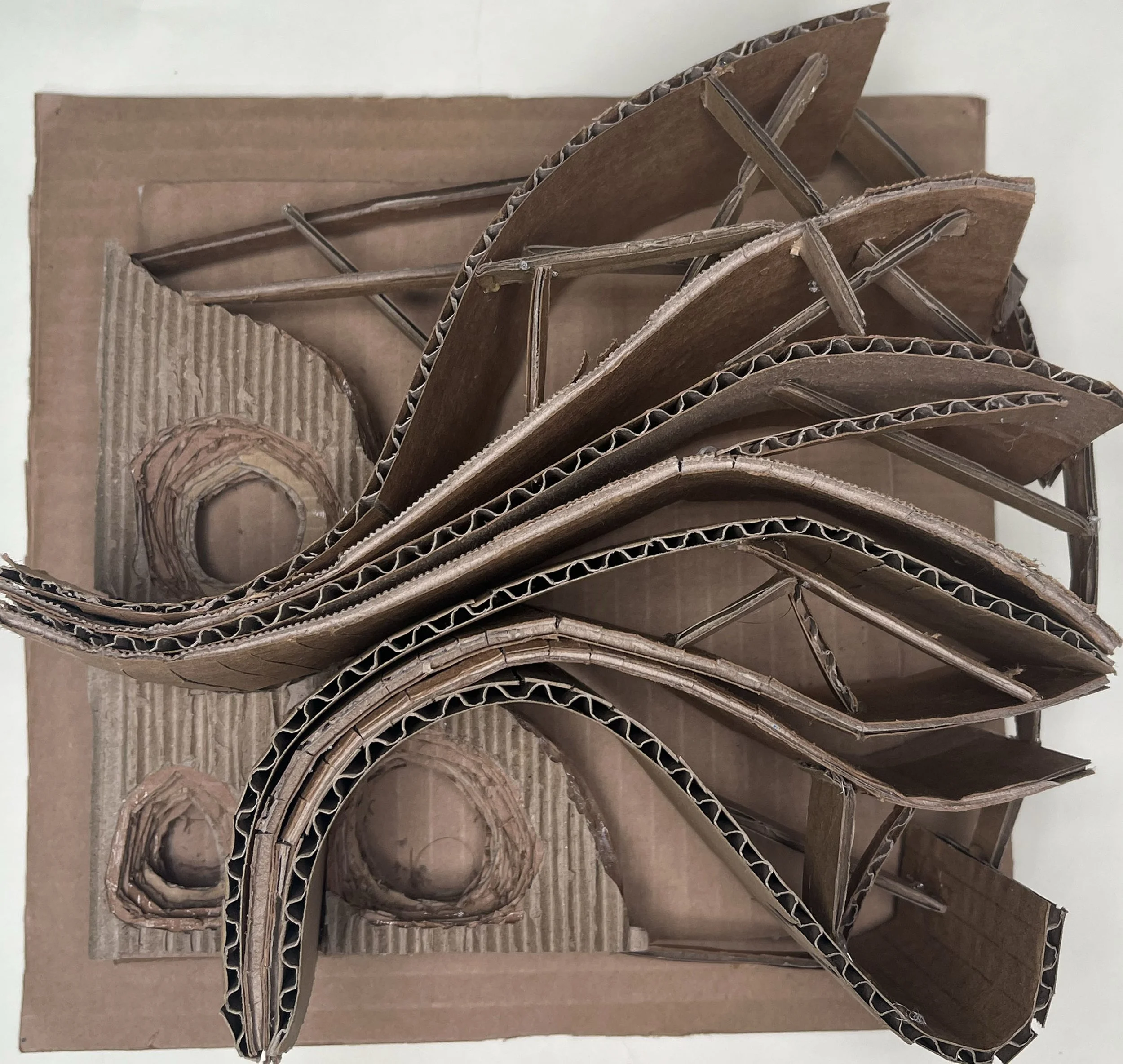
MAPPING CHICAGO THROUGH MATERIAL
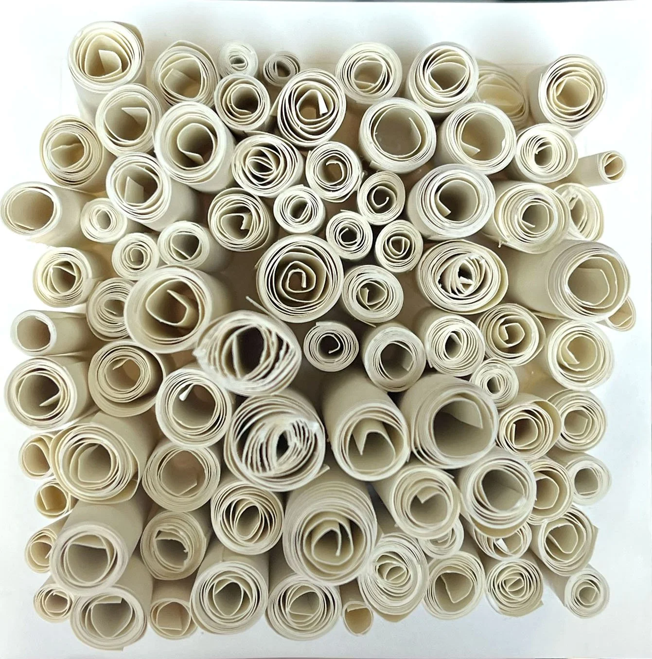
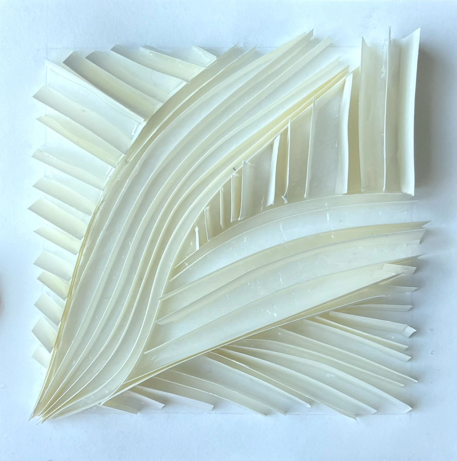
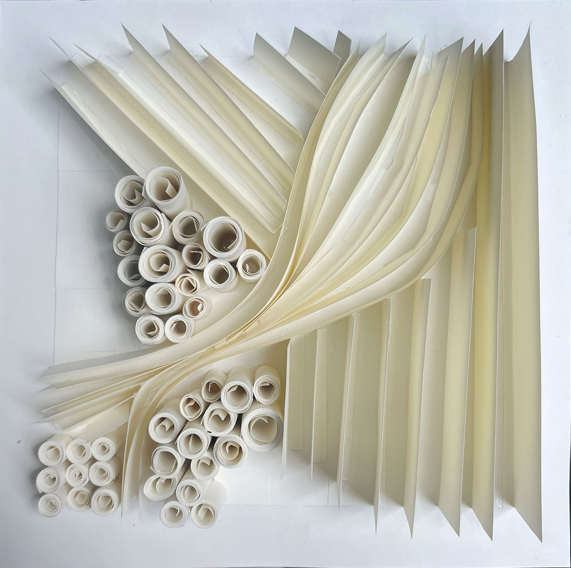
A mixed media study interpreting a map of Chicago through material exploration. Paper, cardboard, denim, string, and plastic elements are used to translate geographic and demographic data into form. Rolled paper and straws represent the city, with varying heights indicating population density. Recycled book pages form the lake as layered waves, while curved cardboard and folded paper explore landscape and movement.